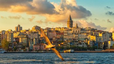
Büyükçekmece ( Bigdrawer) is a district and municipality (belediye) in the suburbs of Istanbul, Turkey on the Sea of Marmara coast of the European side, west of the city. It is largely an industrial area with a population of 380,000.
The land around this inlet of the Sea of Marmara, has been settled, abandoned and resettled throughout history as army after army passed along the coast to the Bosphorus. It is thought to be the site of the Greek colony on the Marmara shore called Athyra (Άθυρα), also known as Athyras.
In 443 AD, the armies of Attila the Hun took this settlement and its associated fort, and this was presumably his last conquest of that campaign before turning around.
The earliest mention of the bishopric of Athyra in a list of dioceses is of the late 15th century, but a seal has been found of a 10th-century Bishop Orestes of the see. No longer a residential bishopric, Athyra is today listed by the Catholic Church as a titular see.
The Ottoman architect Mimar Sinan built a bridge to cross the mouth of the inlet (Lake Büyükçekmece) and there are ruins of inns and caravansarai, which show this was a stopping place on the road to Europe. At the beginning of the Ottoman period, it was empty forest and farmland, and has gradually been settled by Turkish people migrating in from the Balkans and the Caucasus.
According to the Ottoman population statistics of 1914, the kaza of Büyükçekmece had a total population of 13.121, consisting of 9.511 Greeks, 3.255 Muslims, 195 Bulgarians, 143 Roma people and 17 Armenians.
In the early years of the Turkish Republic, it was still very rural, with village cottages, farmland behind, and by the sea the odd weekend home for people of Istanbul. The area was a very popular day or weekend trip from the city, there is a sandy shoreline, a long seafront and until the 1970s families would come out to Büyükçekmece for fishing, crabbing or for a day on the beach.
The area administered by Büyükçekmece includes a large hinterland behind the Marmara shore, some of it still rural.
Lake Büyükçekmece was connected to the sea until it was separated by a dam to supply fresh water to Istanbul. The Mimar Sinan Bridge is located in this area.
Büyükçekmece, of which the settlement began in 7th century BC, was established by Hellenes. The district was known under the name Athyra when it came under the governance of the Byzantines in 2nd century.
After the dominance of Hellenes, Emperor Attila of the Great Hunnic Empire passed through Çatalca with his army, entered Büyükçekmece and returned to his own lands after imposing a levy on the Byzantines in 447 AD. While the Avar Empire reached İstanbul over Çatalca in 616, Bulgarians did the same in 813 under the command of Khan Krum. In the year 1090, Pechenegs were the ones to arrive at Büyükçekmece.
Turks settled in the Byzantine delta in 1357, however Çekmece region continued to be under the dominance of Byzantines for a long time.
After the conquest of İstanbul, Büyükçekmece came under the governance of the Ottoman Empire and was not settled heavily due to it being a summer resort, agriculture district and the camping territory of the Ottoman armies. Büyükçekmece, which was generally used as hunting grounds and winter quarters during the Ottoman era, was settled by a vast number of Turkish immigrants after the Ottoman-Russian battle in 1929.
Büyükçekmece, which came under the governance of Çatalca region in 1876 became a sub-district of Çatalca after Çatalca became a district in 1926. In 1958, Büyükçekmece became a municipality and was announced to be an independent district after being separated from Çatalca in 1987.
During both Byzantine and Ottoman eras, Büyükçekmece was used as a gateway and accommodation point for armies and travelers. Caravanserais, inns and other historical structures such as the famous bridge by Mimar Sinan, some of which have survived until modern times and some of which have simply ceased to exist with ruins and traces long destroyed are significant symbols that attest to the gateway quality of the area.
Today, Büyükçekmece continues to steadily advance on the road to becoming a world city while preserving its character as a gateway or bridge form past to present at the same time. The historical heritage left to us is being protected harmonically within Kültür Park, which is located on the coast of Büyükçekmece Lake.
The district of Büyükçekmece is located on the coast of Marmara Sea, at the western side of İstanbul. Büyükçekmece, which has a surface area of 18.145 hectares, is surrounded by Çatalca and Arnavutköy districts on the north, Esenyurt district on the east, Beylikdüzü district and Marmara Sea on the south and Silivri district on the west.
The district covers 3,5 % of the surface area of İstanbul. Büyükçekmece is a settlement which is located around the bay of the same name in Marmara Sea, including a lagoon of 29 square-kilometers with the same name and a dam lake.
Besides being one of the important summer resorts of İstanbul with a clean, well-organized coastline of 25 kilometers, Büyükçekmece is also a district of İstanbul that connects the past to the present by preserving the historical heritage at the location. From the viewpoint of urbanism, it is a district deserving to be a world city with its resolved settlement, zoning, infrastructure and environment issues and developing profile.
The surface area of the district is 185.145 square-kilometers and this territory consists of slightly rough terrain and plains. There are no forests within boundaries of the district.


Comment (0)